Municipal GIS Program
The Office of Data and Mapping launched a municipal GIS program in the beginning of 2024, to provide professional GIS services and resources to the municipalities within its jurisdiction. The Office of Data and Mapping will offer affordable and comprehensive GIS services for municipalities who enter into an agreement with the County.
By offering a comprehensive GIS program to municipalities, the County promotes efficient data management, collaboration, and resource sharing among local governments. This collaboration helps municipalities leverage GIS technology to address common challenges, make informed decisions, and enhance overall service delivery to their communities.
View more information about this program below:
GEOSPATIAL SERVICES
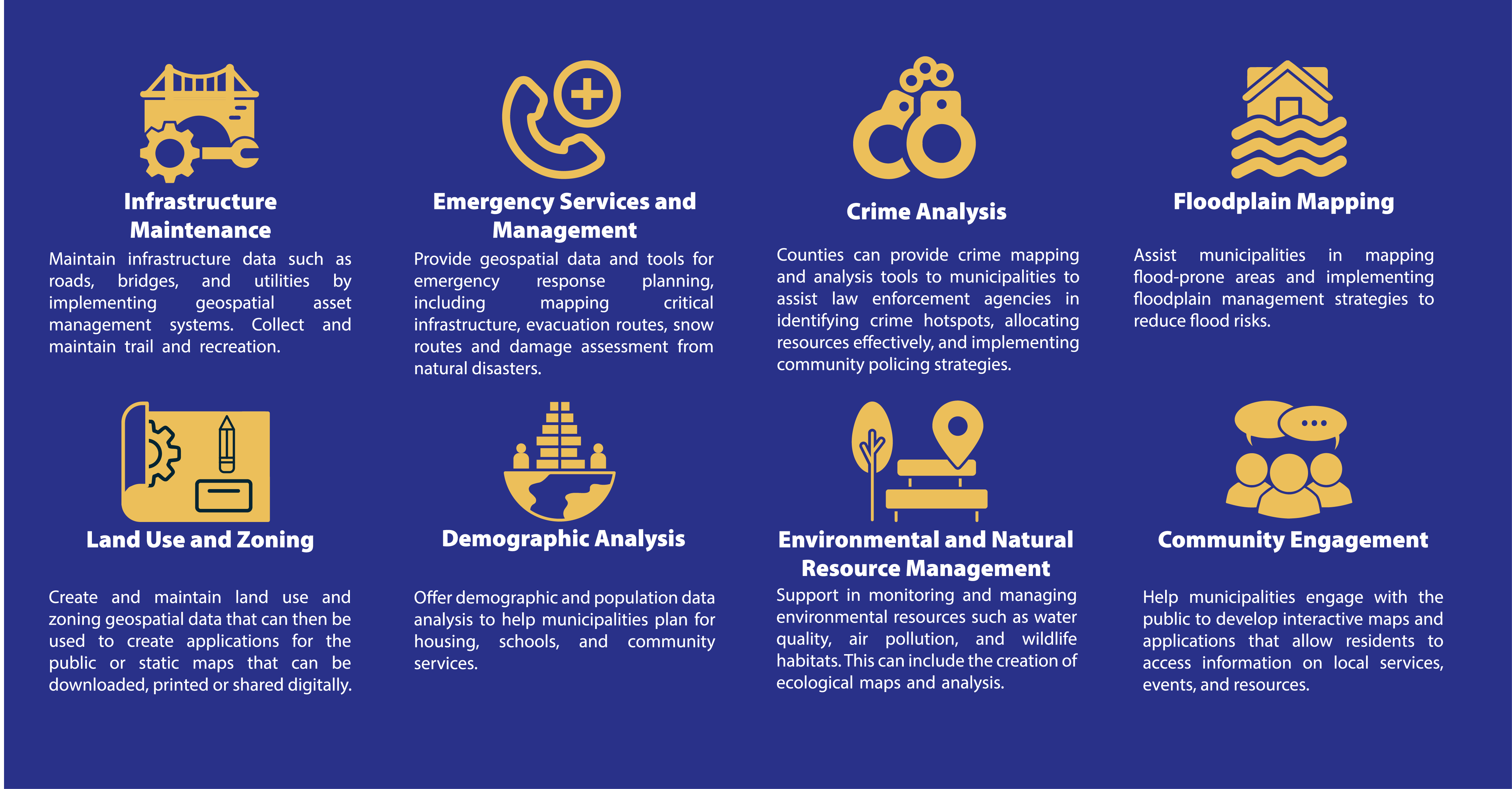
The specific types of geospatial projects/services that the County can offer to municipalities cover a wide range of topics. The specific services the GIS team provides will be tailored on the needs, goals, and priorities of the municipality.
CONTACT
Interested? The GIS team at the Office of Data and Mapping looks forward to providing GIS services and capabilities to all of its municipalities!
Contact Julie DelMuto, GIS Manager at: delmutoj@co.delaware.pa.us or 610-891-4497

Contact Us:
Delaware County Office of Data and Mapping Innovation
Information Technology Division
Office Hours: 8:30am-4:30pm, Monday-Friday
2 W Baltimore Ave
Suite 202
Media, PA 19063
** Please note, we are currently by appointment only. To schedule an appoint, please call or email us as noted below.
Phone #: (610) 871-3899
Email: data_mapping@co.delaware.pa.us
![]()